Road Trip, last day

We woke up early, had breakfast and was on the road by 9:30 AM. Our starting mileage was 106,420.0. We ended our trip at 107,268.3. We put 3800 km on during the trip and spent about $1,500 to make it. Our final mileage was 25.1 l/100 km.

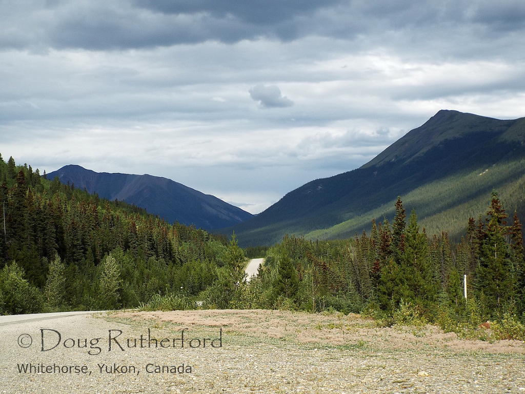
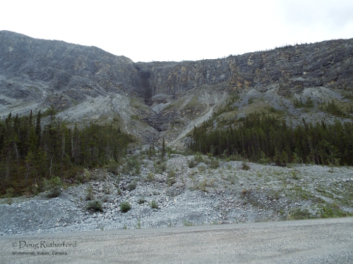
It was a nice drive. I got reminded once again just how beautiful both Stone Mountain and Muncho Lake Provincial Parks are. I do have to make a trip where you do get a chance to have that area as a destination, rather than passing through heading somewhere else.

I also did plan my trip to not drive through either Stone Mountain or Muncho Lake at dusk, or worse yet, after dark. The last time I did that, all you saw on the side of the road was a constant reflection of eyes from sheep, caribou, moose and bison. Never again…

Image
Summit Lake, Stone Mountain Park


Image
Slide area, Stone Mountain Park

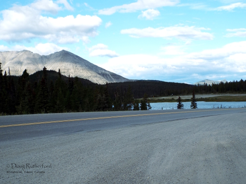
One thing to note after you pass through Muncho Lake Provincial Park: watch for bison on the road. The largest North American land mammal does make a rather substantial obstacle to traffic and they don’t really seem to care that cars and trucks are driving on the road. Challenging one is not on my list of preferred activities. Several groups were on the road between the northern portion of Muncho Lake Park and Upper Liard.

Image
Bison, Upper Liard, BC

By the time you get to Stone Mountain Park, you get to remember some of the winding nature of the Alaska Highway. From here until close to Watson Lake, the road is narrow, with numerous curves and hills. We stopped at Watson Lake to gas up the final time and to grab lunch. It was nice to see the TAGS store there rebuilt after it burned down several years ago. A few details need to be finished but it does add another choice to grab a quick lunch on the road. It was also a chance to remind myself I was back in the Yukon, land of cheap gas. Other than the one stop in La Glace, AB for fuel, most other places in BC had incredibly high gas prices, ranging between $1.59 in Wonowon to $1.64 in Dease Lake per liter.

Image
Nisutlin Bay, Teslin Lake, YT
Image
Teslin, YT. The only picture of me from the trip

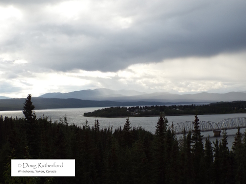
We drove the rest the way back in about 6 hours. We took our time, particularly from the Yukon River Bridge south of town when we got hit with a torrential downpour. It had cleared by the time we got to the house though.

A few general notes. First, if you can’t live without connectivity, this is not the place to come. Internet and cell service was only available in limited places on our trip, and you have to be within a centre, and not on its outskirts to get either. There is no cell service on the highway.

The big observation was another reminder: 14 days on vacation, with 6 full days spent driving. You get an idea of how large this place is…

Road Trip, Day 13

Well, we started the home trip this morning. Our starting mileage was 105,714.2, and we ended with 106,420.0. Total for the day was 705.8 km.

We woke early and started packing for the final trip. Then we got a visit from everyone but the wedding party, and took a quick run to Ernie and Dora’s to drop everyone off so Ernie could show us where the free RV dump was at the Sexsmith Heritage Park. It’s a nice place and seems to have a nice campground there, although we didn’t really have much time to look around. Then, it was off to La Glace, cheating back around Grande Prairie using Highway 59 again. I got gas there, and it was the cheapest I bought on the trip, $1.24 9/10 a liter.

We started driving along, and had a nice drive. The highway was in great shape between Dawson Creek and Fort Nelson. I originally thought we might stay there, but felt like moving on to try this supposedly nice place at Tetsa River, about 115 km past Fort Nelson.

That was quite an eye opener. We ran into construction 35 km past Fort Nelson, and had to wait 30 minutes for a pilot car to run us through. The sign said there would be construction for 1 km, but it turned out to be more than 8 km. We ran into two other areas on either side of Steamboat Hill. The first wasn’t too bad, but the second was rather poor. The speed zone for the construction was 30 km/hr, but don’t try going that fast.

We came into the campground, with a flashing sign on the highway saying “Open.” The office wasn’t, although there was someone inside. I knocked and no one answered. I drove around looking for an open site, and just deal with it in the morning. When I was looking, another camper came over and told me the owner won’t talk to customers after he decides to close up. He doesn’t know what time that is, but we arrived about 7:15 PM. Also, he told me that the power is shut off at 10 PM, since all he has is a diesel generator and it is rather noisy. That’s OK, since our site has no services at all. Apparently very few are serviced, and the electrical power is only 15 amp, not the advertised 30 amp. Also, there is free Wi-Fi advertised, but no Wi-Fi transmitter in the campground. If there was anywhere else to stay, I would have moved on. Unfortunately, that would involve driving through Stone Mountain Park in the dusk, but there’s way too many large animals on the road at that time of night for my liking…


Road Trip, Day 1

After packing the camper over several days, we finally left this morning. We were slightly delayed getting out of Whitehorse, owing largely to me forgetting to register the vehicles and having to wait until Monday morning to do that.

Our starting mileage was 103462.1 km. I got gas at Junction 37 Services (108.61l/437.9 km, or 4.03 km/l). It’s not as good as we got on our first trip to Faro, but not as bad as last time. I suspect our mileage is largely dependent on who fills the tank and how much gas actually gets put in it.

The Alaska Highway is in really good shape. There was only one minor construction area between Whitehorse and the junction with Highway 37 and you missed it in a hurry. However, the first 85 km of the Stewart-Cassiar Highway were terrible. There were lots of frost heaves and this was the most winding part of the road. The speed limit is 80 km/hr., but there is no way you can actually drive that fast. After Km 85, it did get much better until about 25 km before Dease Lake.

The first stretch was so bumpy some of the plates actually fell, opening the cupboard door and exploded on the floor. Some sweeping was called for on the side of the road.

This last run for the day was on even worse highway. There are many frost heaves, gravel patches, and pot holes. Drive carefully through here if you are coming this way. I’m left to wonder that the rest of the Stewart-Cassiar will be like for tomorrow’s drive. We have about 500 km to go on it.

Our daily travel mileage was 672.9 km. It’s not a bad day per se, but I didn’t get as much sleep as I could have last night and I am more than happy we got this far. We stayed at Dease Lake RV Park, which is right in town, or as in town as Dease Lake has. The park is basic, with a full hookup site with pull through costing about $28.

Yukon River Bridge, near the rest area west of Whitehorse.
Cassiar Mountains.
Cassiar Mountains.


Cassiar Mountains.
Cassiar Mountains.


We got into the RV park about 8 PM, counting in the time it took to level and hook up the camper. We waited a bit before making supper and then went to bed.